Professional land surveying services in Ohio

Your Ohio-based partner in land surveying and mapping solutions. We GUARANTEE the lowest price and a 15-business day turnaround from accepted quote to your finished, signed survey — delivered to your inbox.

Call or text: 614-205-0721
30+ Years of Ohio experience
15 Business day turnaround
24 hr Quote turnaround

Free quote

Get a quote from Compass 360

How can we help you? We'll get back to you by end of day.

Loading
Your quote request has been sent successfully. Thank you!

If after 2pm, we'll do our best.

Boundary surveys ALTA / NSPS surveys Title surveys Elevation certificates Construction surveys Topographic surveys Fence surveys Lot surveys

Land surveying services in Ohio

Tired of hearing "we can't start for 8 - 10 weeks'? We get it. When you need a land survey, you need it done right and done soon. That's why Compass360 Surveying guarantees a 15-business day turnaround from accepted quote to your finished, signed survey - delivered to your inbox. While other surveyors are backed up for months, we're ready to help you move forward with your project.

Residential boundary surveys

Many of our customers are homeowners who want to install a fence or otherwise need to know exactly where their property lines are. You probably got a "mortgage survey" when you bought your house, but that's different from a boundary survey — and we're happy to explain the difference when you call.

Commercial and ALTA surveys

Builders and developers choose Compass360 because precision matters in construction, and our GPS/GNSS technology delivers the subcentimeter-level accuracy that prevents costly mistakes. ALTA/NSPS Surveys are the gold standard for commercial properties.

Construction surveys

From plot plans to final as-built surveys, we provide builder services and construction layout with precise positioning for new construction. Our GPS/GNSS equipment delivers centimeter-accurate measurements essential for projects where precision can save you thousands in costly mistakes.

Topographic surveys

Topographic surveys provide detailed land feature mapping for your property. We support site planning with pre-construction land analysis and engineering support so you have the data you need before breaking ground.

15-business day turnaround — guaranteed

From the day you accept our quote, you'll have your finished, certified survey in 15 business days or fewer — while our competitors are telling customers "Maybe next month."

Why clients choose Compass 360

We Actually Answer Our Phone

Call us at 614-205-0721 and talk to a real person about your surveying job, and we can give you a quote, usually within 24 hours. No waiting weeks just to find out if someone can fit you into their schedule.

15-Business Day Turnaround

We know you have deadlines. From the day you accept our quote, you'll have your finished, certified survey in 15 business days or fewer. While our competitors are telling customers "Maybe next month," we're getting the job done.

Subcentimeter-Level Precision with GPS/GNSS Technology

We use advanced GPS and GNSS (Global Navigation Satellite System) equipment that delivers centimeter-accurate measurements. This isn't just impressive technology — it's essential for construction projects where precision can save you thousands in costly mistakes.

Ohio Expertise That Matters

Our Professional Licensed Surveyor (PLS) has decades of experience, especially in the Columbus area. Compass360 knows exactly what each county wants to see in survey drawings for permits and approvals.

What to expect when you work with us

The Quote Process

Call or text Scott directly at 614-205-0721 or submit the quote form on this page. Tell us about your property, what you need the survey for, and your timeline. We'll respond with a quote — usually within 24 hours, often the same day.

Payment and Scheduling

Once you accept the quote, we'll collect a deposit and lock in your field date. We work efficiently and keep your project on track — our 15-business day turnaround is a guarantee, not an estimate.

Field Work Day

Scott and his crew will visit the property to collect measurements using GPS/GNSS equipment and research existing boundary monuments. Most residential surveys require only one field visit. You don't need to be present.

Your Finished Survey

You'll receive a certified, signed, and sealed survey drawing via email — a legal document that can be recorded with the county. This isn't just a sketch; it's professional documentation that protects your property rights.

Coming Soon

Scott Grundei, PLS — 30 years of Ohio surveying

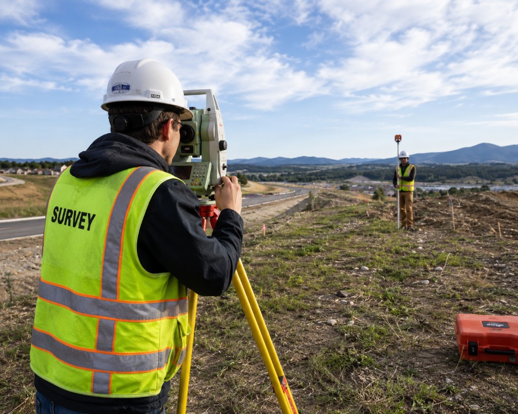
Scott Grundei is a licensed professional surveyor in Ohio with over 30 years of experience delivering accurate, dependable land surveying services. For the past 20 years, Scott led Landmark Survey Group, where he built a strong reputation for quality work and client-focused service throughout the state.

Scott specializes in ALTA, boundary, builder services, and engineering support. His work has supported residential developments, commercial transactions, and construction projects of all sizes, earning the trust of real estate professionals and property owners alike.

Now launching his own firm, Scott is excited to continue serving the Ohio community with the same professionalism, responsiveness, and technical excellence that have defined his career. Whether you're developing land, resolving boundary issues, or preparing for construction, Scott will help you move forward with confidence.